Peachtree City's 100-plus miles of shared-use paths, plus Line Creek, Gin Branch and the PAC bike trail: maps, trailheads, distances and golf cart rules.
Last checked Oct. 6, 2026. Distances, rules and fees come from the city’s own pages, linked. Paving work closes path sections from time to time; check the city’s road and path detour updates before you set out.
Peachtree City’s hallmark is its 100-plus mile network of shared-use paths for pedestrians, cyclists and golf carts, winding through the woods between neighborhoods, shopping centers, schools, parks and lakes, according to the city’s paths and motorized carts page. Add the nature areas and two natural surface bike trails, and you can walk or ride for days without a road. Peachtree City is in Fayette County.
Maps and help
- Interactive map: the city’s path system GIS map
- App: NavigatePTC, for Apple and Android, to find your way and get city alerts
- Printed map: $5 at City Hall, 151 Willowbend Road, and the Visitor Center, 191 McIntosh Trail
- Report a path problem or hazard: the city’s path problem form, or Recreation, 770-631-2525
The trails at a glance
| Trail | Length | Surface | Start or parking |
|---|---|---|---|
| Shared-use path system | 100-plus miles | Paved | Citywide; Drake Field, 155 Willowbend Road, has a bike repair stand and air pump |
| Line Creek Nature Area | Almost 3 miles of trails | Unpaved | Line Creek Drive, off Highway 54 |
| Peachtree City Athletic Complex trail | 3 miles, single track | Natural surface | Peachtree City Athletic Complex |
| Gin Branch Trails | More than 1 mile | Natural surface | 100 World Drive |
| Somerby Woods Nature Area | 0.7 mile out and back | Unpaved | 300 Rockaway Road |
| Huddleston Pond loop | 0.4 mile a lap, lighted | Walking path | Windgate Road at Bridalpath Lane |
| Flat Creek Nature Area | Boardwalk trail | Boardwalk | McIntosh Trail Recreation Complex, 201 McIntosh Trail |
| J.K. “Chip” Conner Island | Loop around the island | Unpaved | Path south from 110 Battery Way |
Sources: the city’s cycling page, nature areas page and park pages.
The path system
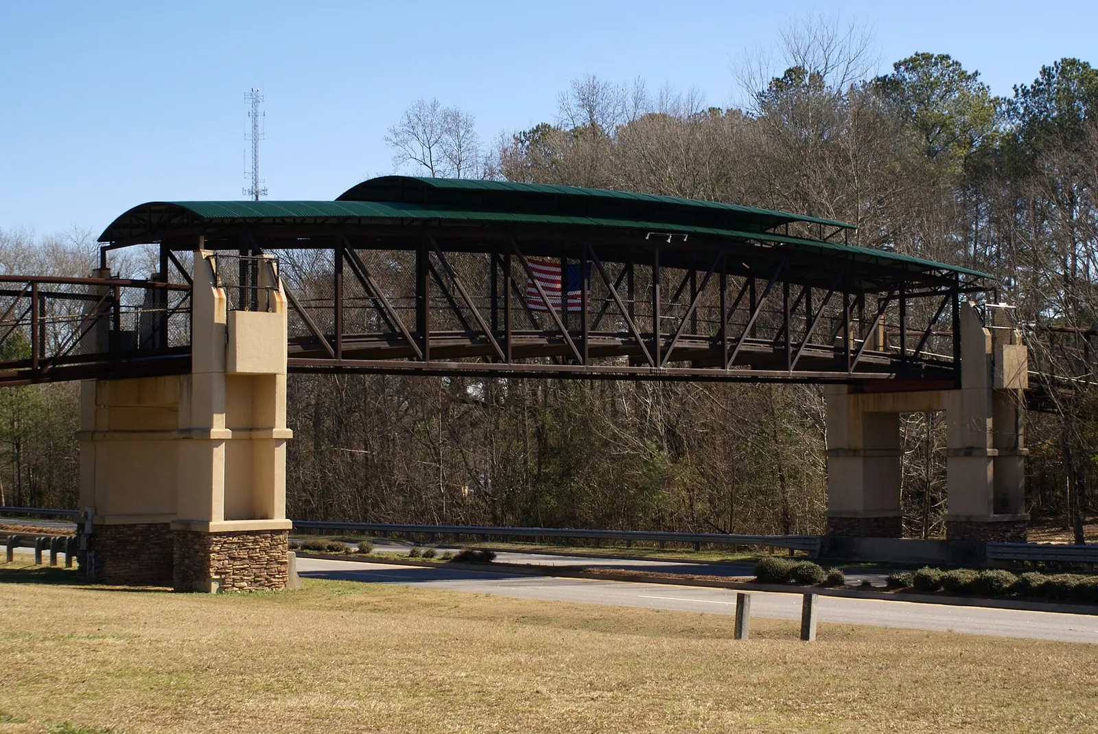
The paths go almost everywhere: from neighborhoods to The Avenue and the village shopping centers, to schools, City Hall, the library and the lakes. A cart and pedestrian bridge carries the paths over Highway 54. The city also marks Huddleston Road, Dividend Drive and Robinson Road as bike-friendly streets with a bike lane or bike route.
A few good outings:
- Lake Peachtree. Park at Battery Way Park, 110 Battery Way, and take the path south to J.K. “Chip” Conner Island, reached by a pedestrian bridge. Our Lake Peachtree guide has more.
- City center. Drake Field, City Hall, the library and the Village Green disc golf course sit together on Willowbend Road, so one short walk takes in all four.
- Lake Kedron. The path crosses Lake Kedron on its own bridge beside Peachtree Parkway.
Nature trails
- Line Creek Nature Area: a 70-acre preserve on the Fayette-Coweta line, with an upland hardwood forest, granite outcrops along the creek, native azaleas, a fishing dock, a gazebo, restrooms and almost three miles of trails. Look for the old mill sites. Parking, the restroom and the pond area are accessible. Leash your dog.
- Somerby Woods: 40 acres, an easy 0.7-mile trail and a small pond, good for birding. The entrance is at the back of a senior living community’s parking lot.
- Flat Creek: a boardwalk through wetlands, starting at the McIntosh Trail Recreation Complex, open sunrise to sunset.
Mountain biking
The Peachtree City Athletic Complex has a 3-mile single-track natural surface trail and a mountain bike park, and the Gin Branch Trails, 100 World Drive, add more than a mile of natural surface trail with a pollinator garden; Gin Branch opened in June 2026. The South Side Cycling Club runs group rides; see its website. AtlantaTrek has a Peachtree City shop that rents bikes, the city says.
Golf carts: the rules
- Register every cart. A city decal is $15 a year; the three-year 2026-28 renewal is $45, due March 31, 2026. Owners must be 18 or older and register in person at City Hall within 10 days of buying a cart.
- Nonresidents pay a $235 yearly path user fee on top of the $15 registration.
- Low-speed vehicles may use the paths if limited to 20 mph, tagged at the Fayette County Tag Office, insured, driven by a licensed driver and fitted with an amber strobe.
- The full rules are in city Ordinance 1253, Chapters 70 and 78, in the Code of Ordinances.
Source: the city’s paths and motorized carts page.
Hours
Parks and nature areas are open dawn to dusk. Trash receptacles sit along the paths; the city asks everyone to use them.
See also: dog-friendly Peachtree City and free things to do.
Frequently asked questions
How many miles of golf cart paths are in Peachtree City?
More than 100 miles of shared-use paths for pedestrians, cyclists and motorized carts, linking neighborhoods, shopping centers, schools, parks and lakes, the city says.
Do I need to register a golf cart in Peachtree City?
Yes. Carts on the paths need a city decal ($15 a year; the 2026-28 renewal is $45). Owners must be 18 or older and register in person at City Hall within 10 days of buying a cart. Nonresidents also pay a $235 yearly path user fee.
Where can I get a Peachtree City path map?
The city has an interactive GIS map of the path system and the NavigatePTC app. Printed city maps cost $5 at City Hall and the Peachtree City Visitor Center.
Are there mountain bike trails in Peachtree City?
Yes. The Peachtree City Athletic Complex has a 3-mile single-track natural surface trail and a mountain bike park, and the Gin Branch Trails at 100 World Drive add more than a mile of natural surface trail.
Are low-speed vehicles allowed on Peachtree City paths?
Yes, if the vehicle is limited to 20 mph, tagged through the Fayette County Tag Office, insured, driven by a licensed driver and fitted with an amber strobe light, the city says.
Have your say